
Bridge 109
A survey of the remains of the bridge
The first bridge 109 would have dated from the opening of the Manchester and Leeds Railway. Passing under the railway just in front of the bridge (and under the locomotive in the photo below) was a culvert, which was part of a system of reservoirs and sluices up the clough to the right, that provided water for Lower Laithe House and its estate, which lie below the railway, to the left in the photo below. This was a private bridge that allowed Lower Laithe House to access and maintain the reservoirs and water supply, so the two were part and parcel of the water supply.
Documents filed with the Land Registry show that when Lower Laithe House was split into a number of self-contained units, emphasis was placed on the 'reservation of rights of running water by means of any existing pipe or pipes beneath the said land'.
The Vendors also reserved the right to inspect, repair and renew 'such pipe or pipes...and also subject to the rights of the owners and occupiers of other properties to a supply of water from the cistern shown on the plan attached hereto and situated in the North Easterly corner of the land hereby conveyed and through the pipes connected therewith as heretofore exercised together with the right of such owners and occupiers to enter on to the land hereby conveyed for the purpose of inspecting repairing and renewing such cistern and pipes as aforesaid'.
The Vendors and their successors in title also have 'free and uninterrupted passage of water to and from the reservoirs ponds cisterns wells and springs situate and being upon the premises thereby conveyed or upon other premises then or theretofore belonging to the Vendors through the pipe lines ...to enter upon the premises for the purpose of maintaining repairing cleansing and renewing all such pipe lines reservoirs etc. on the said premises and in particular reserving the right to use the foot bridge show on the said plan the Vendors or their successors in title making good any such damage or want of repair occasioned by the exercise of the rights and privileges aforesaid'
The land in Kiln Clough, and possibly the reservoirs, appear - again according to Land Registry documents - to have started to be sold off from around 1923. Certainly later Ordnance Survey maps indicate that the reservoir was latterly de-commissioned, with the stream passing under the dam.
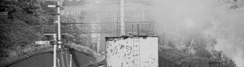
It is thought that a large chicken coup was also maintained by the estate, alongside the culvert, although the dates for its abandonment are not known.
When the line was widened here in a series of works that started in 1895 with the replacement of the level crossing with the current Hall Royd Road bridge, and completed in 1904 with the final commissioning of the signal box, the bridge was replaced, and the culvert extended. No details exist of the original bridge, but the 1904 bridge was of wrought iron construction.
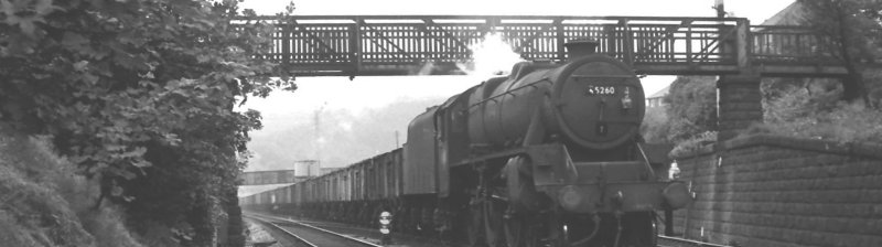
As can be seen from the photo below, the bridge had not been maintained latterly and was in a dangerous state by 1966, and consequently was dismantled by BR in 1973 as part of the Preston power signalling programme in 1973. A 1972 photo shows the bridge to have been liberally covered in rust, with the predominant colour a browny bright orange. Interestingly in the 1966 view it would appear that the bridge did not have any smoke deflectors mounted above the four tracks. This would almost certainly have accelerated the deterioration of the bridge, particularly as Up trains would have been working hard. Yet a photograph dated 1936 - 1938 shows deflectors in place.
Copyright J K Wallace, Photograph P. Eckersley
This 1966 view shows the bridge to in poor structural condition, with railings missing on both sides to the right of the locos smokebox, and above the left hand track there is light showing throguh where decking should be. It would appear that the decking is missing from a whole section of the bridge. The bridge would appear to be painted battleship grey, although the paintwork doesn't look to be in particularly good order.
Copyright J K Wallace, Photograph E. Blakely
Taken in 1965, this photo appears to show the railing slats complete.
Copyright J K Wallace
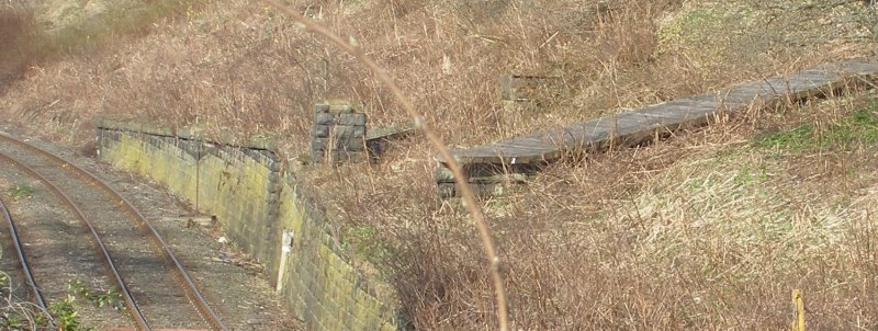
In this 2013 view, the bridge pier on top of the retaining wall is apparent, as is the second pier a short way up the hillside. The culvert is in the foreground, with its slab covering.
Copyright J K Wallace
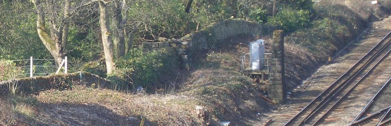
On the other side of the line is a slender pier, which now has a set of cabinets behind it mounted on a platform. Careful study of the pier will show that on the seventh row of stones from the bottom, the number '109' is crudely painted on. The bridge terminated in a stone structure which is slightly higher that the boundary wall. The Ordnance Survey map shows that the path on the other side of the wall ran parallel with the wall before looping back as it lost height.
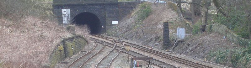
Copyright J K Wallace
The site of bridge 109 looking eastwards from Hall Royd Road bridge.
Copyright Nigel Trafford, all rights reserved
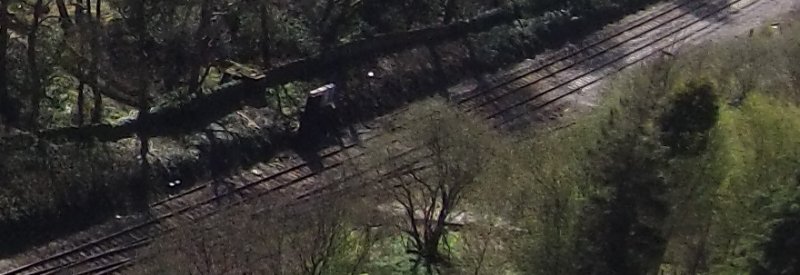
This aerial view shows the two southerly piers. The bridge was provided so that the occupants of Lower Laithe House could access their water supply. The culvert from the reservoir can be seen approaching the railway in the centre of the photograph, whilst the open culvert can be seen descending through the trees beyond the wall.
Finally, an impression of how the bridge looked can be gained from these two photos of the model.
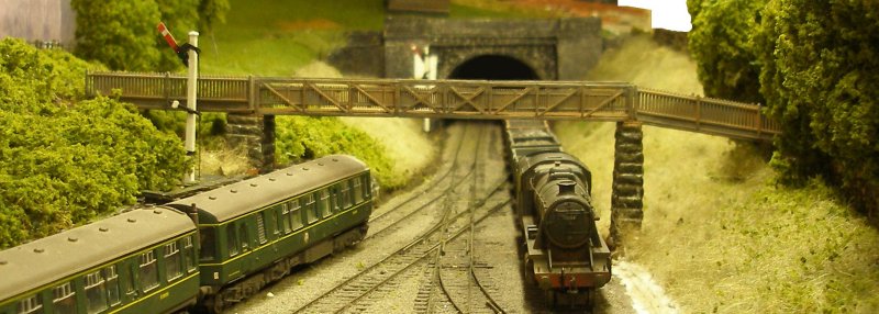
All images copyright J K Wallace c.2015
.
Copyright J K Wallace, t/a 'Hall Royd Junction' 2013-2023 email: Hall Royd Junction
7 Portobello Close, Chesham, Bucks. HP5 2PL, UK
tel: +44 (0)7513 412880