
Liverpool - Southport Line: Blundellsands & Crosby - Waterloo
(Merseyrail Northern Line)
Our journey today starts at Southport Chapel Street and follows the line to the site of the erstwhile Liverpool Exchange using Google Streetview images. Should you use the individual Google navigation tools, and wish to restore the page to its default views, just refresh the page.
As it takes a few seconds for each of the Google maps to be retrieved, the line is broken into sections, and generally these are station-to-station. Each Google Streetview image is presented facing the direction of travel, in this case southwards. The intention is that to see the northwards view, the Google navigation tool needs to be used.
Mersey Road bridge is located south of Blundellsands & Crosby Station bridge.
Booke Road East leel crossing
St John's Road level crossing, Waterloo
Waterloo Station entrance
Crosby Road North, otherwise known as 'Five Lamps'
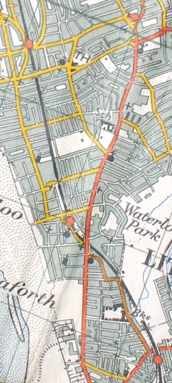
Reproduced from the 1961 Ordnance Survey map.
Click here for the line southwards to Bootle & Liverpool Exchange
Copyright J K Wallace, t/a 'Hall Royd Junction' 2013-2023 email: Hall Royd Junction
7 Portobello Close, Chesham, Bucks. HP5 2PL, UK
tel: +44 (0)7513 412880