
Manchester - Normanton via Todmorden: Manchester Victoria - Bromley Street
The journey starts at Manchester Victoria and follows the Calder Valley mainline of the Lancashire & Yorkshire Railway to Normanton via Todmorden using Google Streetview images. Should you use the individual Google navigation tools, and wish to restore the page to its default views, just refresh the page.
As it takes a few seconds for each of the Google maps to be retrieved, the line is broken into sections, and generally these are station-to-station. Each Google Streetview image is presented facing the direction of travel, in this case eastwards - unless otherwise stated.
Next >
Cheetham Hill Road bridge. This view from the end of the bridge shows the tracks heading off up Miles Platting, and where there is now a modern office block, once there was a signal box. Where the steps leading down there in train spotting days?
Red Bank. This is immediately east of Manchester Victoria, and shows the viaduct that carries the railway at this point. Photos of the Lancashire & Yorkshire Calder Valley line often feature the 'Red Bank Parcels' - usually the empties returning to Manchester during day-light hours, having deposited its newspapers in Newcastle. It therefore seemed appropriate to include a view of this famous street, although the buildings in view do not look much like newspaper publishers.
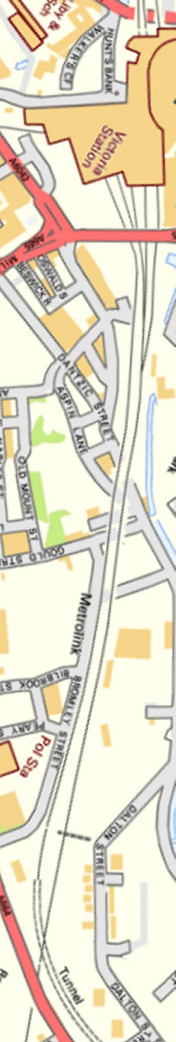
The viaducts forming the Victoria approaches seen from Gould Street.
Bromley Street looking towards Victoria
Contains Ordnance Survey data © Crown Copyright and database right 2013
Copyright J K Wallace, t/a 'Hall Royd Junction' 2013-2023 email: Hall Royd Junction
7 Portobello Close, Chesham, Bucks. HP5 2PL, UK
tel: +44 (0)7513 412880