
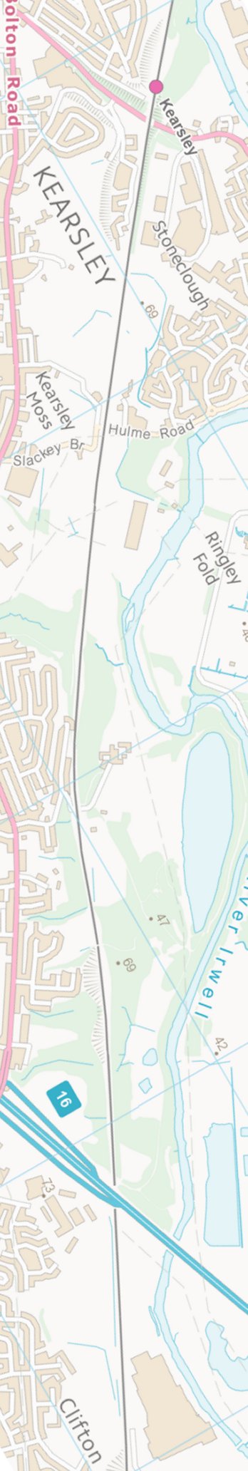
Manchester - Southport Line via Wigan and Bolton: Kearsley - Doe Brow bridge
Our journey today starts at Southport Chapel Street and follows the line to Manchester Victoria via Bolton using Google Streetview images. Should you use the individual Google navigation tools, and wish to restore the page to its default views, just refresh the page.
As it takes a few seconds for each of the Google maps to be retrieved, the line is broken into sections, and generally these are station-to-station. Each Google Streetview image is presented facing the direction of travel, in this case eastwards. The intention is that to see the northwards view, the Google navigation tool needs to be used.
Kearsley Station entrance and bridge. This section of line was originally built as a canal, and the bridge looks more like an aqueduct than a regular rail structure.
A Pacer is aspyed lurking in the shrubbery at the end of 'Hazelmere'.
Hulme Road bridge also looks more canal than railway.
Doe Brow - difficult to get the angle, but another ex-canal bridge.
Contains Ordnance Survey data © Crown Copyright and database right 2013
Copyright J K Wallace, t/a 'Hall Royd Junction' 2013-2023 email: Hall Royd Junction
7 Portobello Close, Chesham, Bucks. HP5 2PL, UK
tel: +44 (0)7513 412880