
Manchester - Southport Line via Wigan and Bolton: Hoscar - Parbold
Our journey today starts at Southport Chapel Street and follows the line to Manchester Victoria via Bolton using Google Streetview images. Should you use the individual Google navigation tools, and wish to restore the page to its default views, just refresh the page.
As it takes a few seconds for each of the Google maps to be retrieved, the line is broken into sections, and generally these are station-to-station. Each Google Streetview image is presented facing the direction of travel, in this case eastwards. The intention is that to see the northwards view, the Google navigation tool needs to be used.
Hoscar is the first station out from Burscough , and again the platforms are now either side of the crossing so that trains picking-up passengers do not unduly delay road traffic. There are three level crossing between Burscough and Hoscar but sadly the Google van did not think to include them... Note the original railway building now sold off and separated from the live railway by a wooden fence.
The Google camera stopped short of the gates at Frog Lane, but again, the original railway house next to the crossing looks both original and in good order.Deans Lane level crossing again has the original crossing keeper's house, and it is remarkable that so much of the original infrastructure has survived.
View Larger Map
Parbold Station is on the money: original, functioning signal box; level crossing and original station building in very good order, albeit now a private residence.
View Larger Map
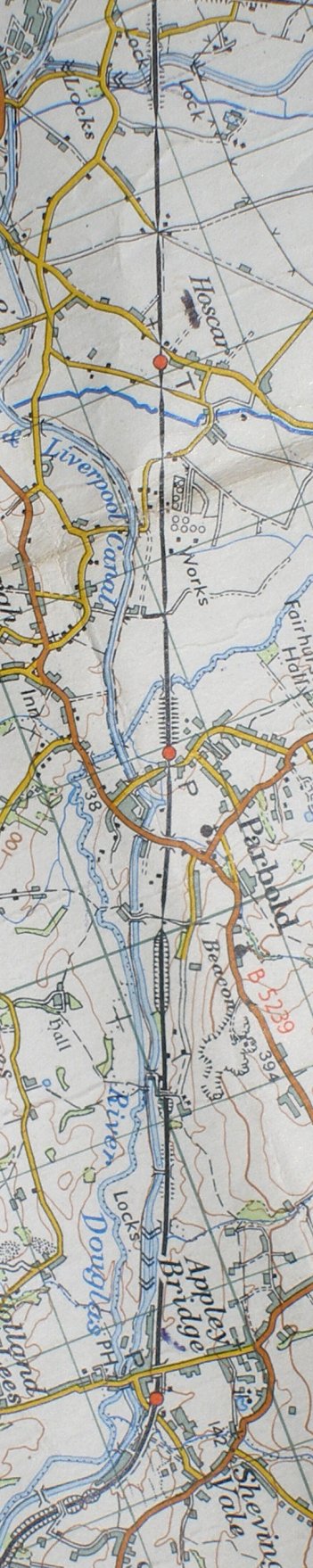
Reproduced from the Ordnance Survey Map 1961
Copyright J K Wallace, t/a 'Hall Royd Junction' 2013-2023 email: Hall Royd Junction
7 Portobello Close, Chesham, Bucks. HP5 2PL, UK
tel: +44 (0)7513 412880