
Liverpool - Southport Line: Ainsdale - Whitehaven Close
(Merseyrail Northern Line)
Our journey today starts at Southport Chapel Street and follows the line to the site of the erstwhile Liverpool Exchange using Google Streetview images. Should you use the individual Google navigation tools, and wish to restore the page to its default views, just refresh the page.
As it takes a few seconds for each of the Google maps to be retrieved, the line is broken into sections, and generally these are station-to-station. Each Google Streetview image is presented facing the direction of travel, in this case southwards. The intention is that to see the northwards view, the Google navigation tool needs to be used.
Ainsdale Station, looking south across the platforms.
The lines passes Chesterfield Road before...
...passing under Kenilworth Road bridge. This was a 'new' bridge, constrcuted as this part of Ainsdale developed in the 1970s, and communiction was improved with a connection to the Coast Road.
The famous sand dunes are visible in this view from Whitehaven Close.
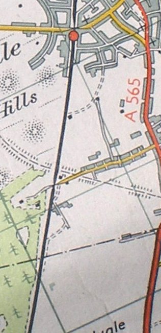
Reproduced from the Ordnance Survey 1961
For the next section of line to Freshfield, click the link...
Copyright J K Wallace, t/a 'Hall Royd Junction' 2013-2023 email: Hall Royd Junction
7 Portobello Close, Chesham, Bucks. HP5 2PL, UK
tel: +44 (0)7513 412880