
Liverpool - Southport Line: Coast Road-Freshfield
(Merseyrail Northern Line)
Our journey today starts at Southport Chapel Street and follows the line to the site of the erstwhile Liverpool Exchange using Google Streetview images. Should you use the individual Google navigation tools, and wish to restore the page to its default views, just refresh the page.
As it takes a few seconds for each of the Google maps to be retrieved, the line is broken into sections, and generally these are station-to-station. Each Google Streetview image is presented facing the direction of travel, in this case southwards. The intention is that to see the northwards view, the Google navigation tool needs to be used.
The conversion of the Cheshire Lines Committee alignment from the outskirts of the town through to Birkdale Palace station greatly improved the road network and reduced congestion in the south of the town. This view is worth orientating both left and right to obtain a feel for what travel on the Southport Extension might have felt like. A three-car ekectric unit (class 507 otr 508) passes underneath bound for Liverpool.
Pinfold Lane, Southport. The line passes now behind Woodvale aerodrome, which sadly Google failed to penetrate, including Fisherman's Path.
Freshfield Station is now reached, and this view is from the Southport end of the car park.
A new waiting shelter sits proudly on the Liverpool-bound platform.
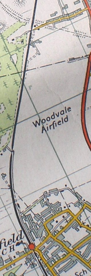
Reproduced from the Ordnance Survey 1961
For the next section of line to Formby and Waterloo, click the link...
Copyright J K Wallace, t/a 'Hall Royd Junction' 2013-2023 email: Hall Royd Junction
7 Portobello Close, Chesham, Bucks. HP5 2PL, UK
tel: +44 (0)7513 412880