
Liverpool - Southport Line: Seaforth & Litherland - Marsh Lane - Bootle New Strand
(Merseyrail Northern Line)
Our journey today starts at Southport Chapel Street and follows the line to the site of the erstwhile Liverpool Exchange using Google Streetview images. Should you use the individual Google navigation tools, and wish to restore the page to its default views, just refresh the page.
As it takes a few seconds for each of the Google maps to be retrieved, the line is broken into sections, and generally these are station-to-station. Each Google Streetview image is presented facing the direction of travel, in this case southwards. The intention is that to see the northwards view, the Google navigation tool needs to be used.
Knowsley Road, Bootle, showing the bridge abutments, widenened at this point for four tracks, two carrying the Liverpool - Southport service , and two docks traffic off the North Mersey branch - and - back in the 50's the alternative passenger service to Aintree.
At Marsh Lane, there is a glimse of a train crossing the road brodge just outside the station. One thing that marks out the Liverpool - Southport line is its high frequency service, and the number of Google Streetview 'grabs' for this line that feature a train. Tweek the camera to the left and the station comes into view.
Compared to the Southport end of the line, the run into Liverpool is mainly above street level either on embankment or viaduct, and so there are fewer opportunities for views of the actual line. Here is the bridge over Strand Road in Bootle.
The line now passes over Carolina Street....
...and then Merton Road.
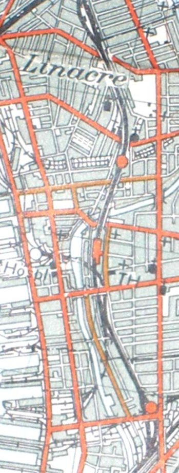
Reproduced from the 1961 Ordnance Survey map.
Copyright J K Wallace, t/a 'Hall Royd Junction' 2013-2023 email: Hall Royd Junction
7 Portobello Close, Chesham, Bucks. HP5 2PL, UK
tel: +44 (0)7513 412880