
Liverpool - Southport Line: Bootle Oriel Road - Bootle Junction
(Merseyrail Northern Line)
Our journey today starts at Southport Chapel Street and follows the line to the site of the erstwhile Liverpool Exchange using Google Streetview images. Should you use the individual Google navigation tools, and wish to restore the page to its default views, just refresh the page.
As it takes a few seconds for each of the Google maps to be retrieved, the line is broken into sections, and generally these are station-to-station. Each Google Streetview image is presented facing the direction of travel, in this case southwards. The intention is that to see the northwards view, the Google navigation tool needs to be used.
Bootle Oriel Road station has benefitted from a major upgrade, and still looks remarkable pristine from the road.
At Millers Bridge, the line continues its way southwards towards Liverpool, but if the camera angle is reversed to look the other way, the LNWR dock's branch can just be seen emerging from its tunnel.
Although not strictly Liverpool - Southport, this 'grab' is located over the LNWR tunnel mouth allowing loxser inspection of this ex-station site.
From King's Road, there is an opportunity to see somthing of the local railway landscape.
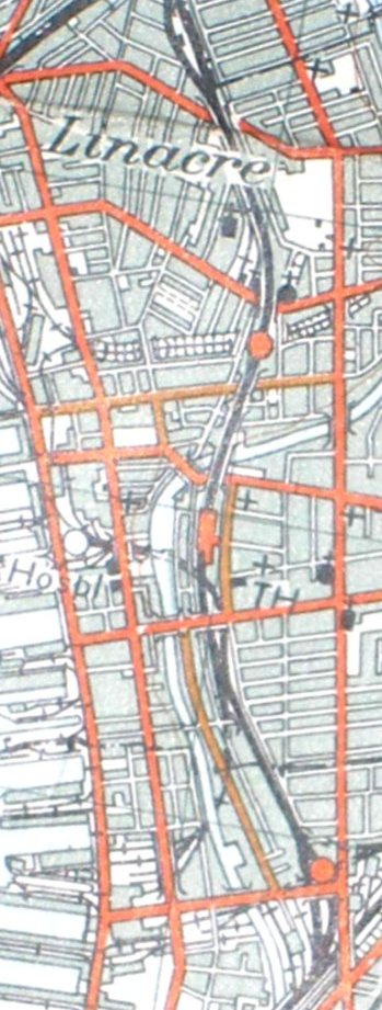
Reproduced from the 1961 Ordnance Survey map.
Copyright J K Wallace, t/a 'Hall Royd Junction' 2013-2023 email: Hall Royd Junction
7 Portobello Close, Chesham, Bucks. HP5 2PL, UK
tel: +44 (0)7513 412880