
Manchester - Southport Line via Wigan and Bolton: Southport Chapel Street - Meols Cop
Our journey today starts at Southport Chapel Street and follows the line to Manchester Victoria via Bolton using Google Streetview images. Should you use the individual Google navigation tools, and wish to restore the page to its default views, just refresh the page.
As it takes a few seconds for each of the Google maps to be retrieved, the line is broken into sections, and generally these are station-to-station. Each Google Streetview image is presented facing the direction of travel, in this case eastwards. The intention is that to see the northwards view, the Google navigation tool needs to be used.
Trains for Manchester did - and still do - depart from Platforms 4, 5 and 6. Platforms 7 and 8 were for trains going via the Preston Line, whilst the Crossens electrics used Platforms 9 & 10. Sadly the northern side of the trainshed was demolished to create the open area seen here.
St Lukes Bridge was a favourite location for me as a child, as there were two sets of bracket signals that rose above the bridge girders here, one set on the Manchester line (to the right of the current view) and a second set on the Preston line. The island platform was between the tracks at this location, whilst the headshunt from the goods yard ran to the left of the Manchester-bund track.
The view over the fence from Hart Street allows a detailed examination of the site of the Preston-line platforms at St Lukes, now completely removed. There was an urban legend that a Stanier Coronation Pacific was gauged through the platforms here but hit the platform edging.
The view from Sussex Road bridge nicely illustrates the only section of the West Lancashire Railway still open, with the tracks heading for Hawkshead Street bridge. Spinning the camera round reveals the site of St Lukes station, and the footprint of the island platform.
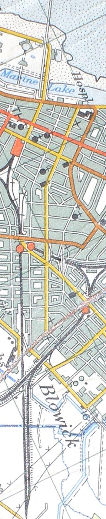
Reproduced from the 1961 Ordnance Survey map
Copyright J K Wallace, t/a 'Hall Royd Junction' 2013-2023 email: Hall Royd Junction
7 Portobello Close, Chesham, Bucks. HP5 2PL, UK
tel: +44 (0)7513 412880