
Manchester - Southport Line via Wigan and Bolton: Hawkeshead Street bridge - Meols Cop
Our journey today starts at Southport Chapel Street and follows the line to Manchester Victoria via Bolton using Google Streetview images. Should you use the individual Google navigation tools, and wish to restore the page to its default views, just refresh the page.
As it takes a few seconds for each of the Google maps to be retrieved, the line is broken into sections, and generally these are station-to-station. Each Google Streetview image is presented facing the direction of travel, in this case eastwards. The intention is that to see the northwards view, the Google navigation tool needs to be used.
At this point we are looking ahead towards the site of the Meols Cop Electric Maintenance workshops. This consisted of a main workshop with four roads and overhead lifting gear. Once abandoned by BR, the doors were recovered for further use at the Steamport Southport rail museum (now Preston), and the wooden blocks forming the flooring being sold for firewood. Slightly to the right - but to the left of the tracks - was the signal box for the junction, with the line to Preston passing to the left. When the line closed in September 1964, buffer stops were inserted at the junction-end, and the ex-running lines used to store electric stock, by this time just the 502s were running.
Meols Cop station is 'open' in two senses of the word: you can catch both a train and a cold here, as the wonderful wooden L&YR covered foot bridge, station buildings and awning have all gone, but trains still call. When the electric services ran from Chapel Street to Crossens, those heading towards Southport called in here at the left hand side platform, before reversing out to head for St. Lukes.
From Hawthorne Crescent the line can be seen heading out of the town. At this point there was always just two running lines, but it is apparent that the formation is wider, and this accommodated the headshunt from Meols Cop goods yard which also doubled as a spur connecting with the Southport Gas Works tramway. The goods yard always seem to have a healthy coal traffic as well as a well stocked builder's merchants.
Another shot from Hawthorne Crescent... The gate is slightly open, so one has to assume that team have the appropriate permissions to recover this rail handily left near the boundary.
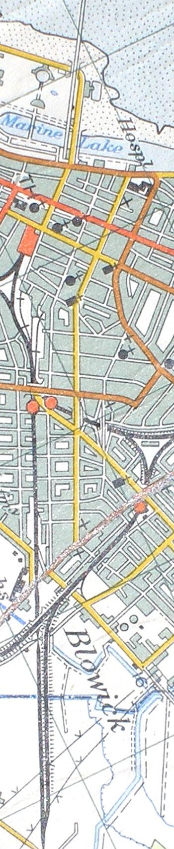
Reproduced from the 1961 Ordnance Survey map
Copyright J K Wallace, t/a 'Hall Royd Junction' 2013-2023 email: Hall Royd Junction
7 Portobello Close, Chesham, Bucks. HP5 2PL, UK
tel: +44 (0)7513 412880